
Finding Who Lives Along a Michigan Street
To trace a Michigan address, begin with its county and municipality, then carry the parcel number into the next record system. A local assessment card can show the owner on file and the parcel’s situs, the place where the land sits. A county map can connect that parcel to a street segment. Deeds add transfer history, while voter records and older directories offer different, limited views of people tied to the address.
These sources do not make one list of everyone living along a street. An owner may live elsewhere, and a registered voter is only one person in a household. A Michigan street directory search is strongest when the same parcel, name, date, or municipality appears across two records.
- Choose the county and municipality that contain the street, then open the local assessor or BS&A search.
- Search by address and save the owner, parcel ID, situs address, mailing address, and legal description shown.
- Open the county GIS map, confirm the parcel boundary, and note how the map links to assessor detail.
- Search the county deed index by owner or legal description; use the local cutoff and image access rules.
- For registered voters, use the individual status lookup or request a lawful geography through the QVF form.
- For a past household, ask a library about its Bresser or Polk street section and the years it holds.
If the address is on a private road, rural route, older plat, or renamed street, the parcel description may be a better key than the current street label.
Michigan Street Records Begin With County
Michigan has 83 counties and no single statewide public deed index or owner-linked parcel viewer. A street that crosses a city line may also cross a county line, so a municipality name alone may not identify the land custodian. The state’s Register of Deeds list identifies the local land office, while its tax-parcel page points to county-maintained layers. Each county and city sets its own search fields, map layers, and historic cutoffs.
Resolve the county before entering a name. If an early deed or plat uses a predecessor county, check the event date and ask the current Register of Deeds or the Archives of Michigan where that record is held. A search result from one county cannot rule out a record indexed by the neighboring county.
Michigan Assessor Records Use Local Fields
BS&A Online begins with a municipality selector. After that choice, a local property page may accept an owner name, street address, parcel ID, or tax account. The same street can be shown differently across municipal systems, so try the parcel ID after the address search gives a result.
| Portal or Control | Field | Type | Use and Limit |
|---|---|---|---|
| BS&A / assessor | Municipality or county | Required dropdown | Select the local government before searching. |
| BS&A / assessor | Owner name or street address | Optional text or autocomplete | Matching and address format vary by municipality. |
| Assessor detail | Parcel or property ID | Optional text | Save the local code as the stable link to the parcel. |
| County GIS | Address or parcel search | Optional text or autocomplete | Zoom to the parcel; owner details may link out or be absent. |
| County GIS | Parcel, road, address-point, district layers | Map controls | View lot edges and boundaries; layer sets are local. |
| Ingham deed portal | Party/grantor/grantee; legal description | Optional text | Use name variants or a parcel description when address search fails. |
| Ingham deed portal | Date range; book/page; document number; type | Optional fields | Limit common-name results; document choices vary by vendor. |
County systems may also offer tax history, principal-residence exemption, sale references, or a building sketch. None is guaranteed statewide. A field marked homestead can support an owner-occupancy question, but it does not prove who is inside the home now.
Michigan GIS Maps Show Parcel Edges
Open the county map after an address or parcel search, turn on parcel boundaries, and select the lot. Some viewers send the parcel ID to the assessor card; others show a map popup without owner data. Aerials, roads, address points, zoning, flood layers, voting precincts, and school or municipal boundaries can help orient the record, but they do not name every person at the address.
For a block, click each parcel that touches the street or use a selection, measure, or buffer control if the county provides one. Common areas, alleys, condominium parcels, vacant lots, and off-site mailing addresses can make the visible parcel shape differ from an ordinary home lot. Michigan DTMB describes the county-maintained system on its tax-parcel page.
The state has GIS and address standards, not a universal neighbor map. Use local GIS for ownership links and the Michigan GIS maps hub for statewide boundary context; do not treat one map layer as a complete resident directory.
Michigan Address Records Searchable Along a Street
Address-keyed records answer different parts of a street question. The assessor shows a parcel owner and tax fields; the county GIS map gives lot shape and boundary context; the Register of Deeds shows instruments tied to the land. Voter data, permits, and historical volumes add other dates or affiliations, each with its own scope and access rules.
| Street Record | Custodian | What It Can Show | Access Route |
|---|---|---|---|
| Property and tax roll | City, township, or county assessor | Owner on file, parcel, situs and mailing addresses, values, exemption | Local portal, assessor counter, or FOIA |
| GIS parcel map | County or municipality | Parcel edges, roads, address points, map layers | County viewer; fields and layers vary |
| Deeds and liens | County Register of Deeds | Grantors, grantees, instrument dates and legal description | Index, paid image, mail copy, vault, or counter |
| Voter record | Michigan Bureau of Elections and local clerks | Registered names and lawful public fields by selected geography | Individual status or formal QVF request |
| Permits and code cases | Local building or enforcement office | Address, permit, applicant and dated work where public | Local portal, LARA for state permits, or request |
| Polk / Bresser volume | Library or local-history collection | Past household head, street order, phone, occupation or move note | Print, microfilm, library database, or reference desk |
| Plat or historic map | LARA, county recorder, library, or archive | Lot, block, old road, street name and building form | State copy, county original, or local collection |
Save the parcel ID before leaving the assessor record. It can connect a tax card to GIS and a deed even when the modern street label has changed. A QVF request, by contrast, is scoped by county, jurisdiction, district, ward, or precinct, not by a public ZIP or street roster.
Michigan Mailing Addresses Are Not Situs
The situs address names where a parcel is located. The owner’s mailing address is where tax or other notices go. They can differ because the owner lives elsewhere, uses an agent or business address, or receives mail at a designated address. Record both values as labeled; do not call a mailing address the resident’s home.
A principal-residence or homestead field may support an owner-occupancy question, but local field rules matter and the flag is not proof of who currently lives inside. If an address is protected under Michigan’s Address Confidentiality Program, do not use another file to infer a physical location.
Michigan Parcel Cards Show More Than Ownership
A parcel card is the bridge from a street number to the legal land record. A local assessor record may carry these fields, though each municipality publishes a different set:
- Municipality, parcel or property code, and tax account.
- Owner name, mailing address, and situs address.
- Legal description, acreage, land class, and building use.
- Taxable value, assessed value, state equalized value, and homestead flag.
- Sale or property history, tax history, and building sketch where available.
- Parcel
- A local unit of land tracked for assessment and mapping.
- Situs address
- The location address assigned to the land or building, distinct from its tax-mailing address.
- Plat
- A recorded map that lays out lots, blocks, streets, and easements.
- Criss-cross directory
- A historical directory arranged by street and house number, often with a household head and phone.
Save the card’s date and parcel code with any copied notes. For a subdivision map, the LARA plat search offers state copies for all 83 counties; ask the county Register of Deeds for an original or certified plat. If an assessment field is missing online, ask the assessor whether an office print, archived roll, or written public-record request is available.
Michigan Deed Chains Start by County
A county deed search may index a grantor, the person transferring an interest, and a grantee, the person receiving it. Search the current owner as grantee to find the purchase instrument, then search the seller as grantee for the earlier deed. Keep the instrument number, recording date, book and page, and legal description before stepping back again.
Address alone may fail when a parcel was split, combined, or described by lot and block. In that case, use the legal description or the parcel number. A deed index is not a title opinion, and the party on a record is not necessarily a resident of that parcel.
Ingham’s Deed Index Has a Date Caveat
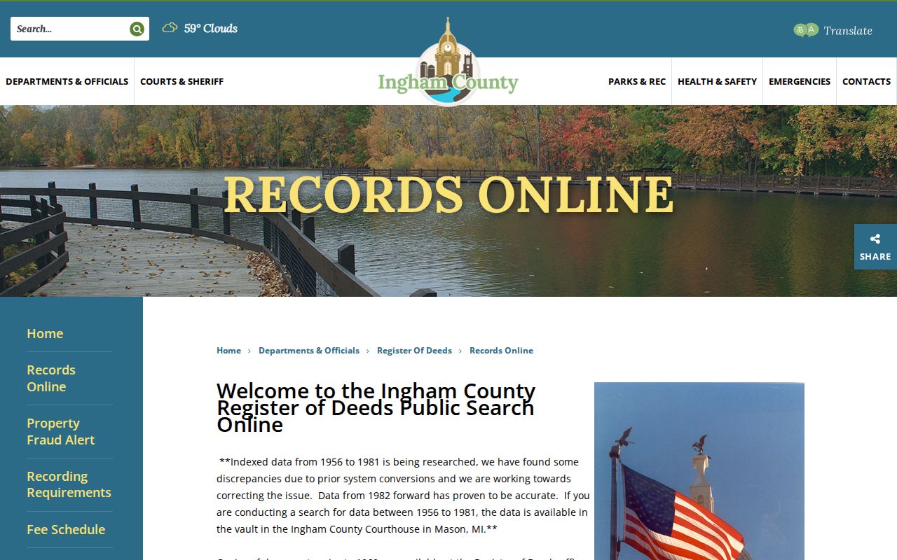
Ingham County Records Online illustrates a useful split between the index and the image. Direct Search is free but index-only and excludes the last seven days. Tapestry is a one-time paid search; Laredo is a subscription option. The index reaches back to 1956, while images begin in 1960.
The county reports conversion discrepancies in 1956-1981 entries and says the later indexing is more reliable. Public searching in the Mason courthouse vault is available by appointment; pre-1960 copies remain at the office. Copies may be requested by mail using a name plus property description, book/page, or document number. This insider warning is a reason to check the local notice before treating a blank online street search as a gap in ownership.
The county’s page explains the local search choices and limits. The screenshot shows the entry point; it does not promise that every Michigan county has the same vendor, years, or fee structure.
For older material, ask the county Register of Deeds or check the Archives of Michigan county guide for a partner repository. A document image online and a certified county copy are different access routes.
Michigan Voter Records Use Geography
An individual can check registration status at Michigan.gov/Vote, which can also help find the correct local clerk. A broader QVF request requires one geographic scope on the official form, such as a county, city or township, district, ward, or precinct. It is not an address-by-address public directory.
Authorized files may include name, residence or mailing address, birth year, registration date, status, and available history. The law withholds full birth date, driver or state-ID number, phone, email, signature, SSN4, and a declination record. The signed QVF request form also requires one geographic scope and a delivery choice. A protected voter may use an Address Confidentiality Program substitute address; do not try to trace behind it.
When an individual lookup cannot answer a question, the local clerk is the fallback for registration and election records. Historical poll books and registers may be held at a county clerk’s office, library, or archive rather than in the current online form.
Michigan Permits Stay With Local Offices
A building permit may add a date and applicant to the history of a street address. Michigan has no single statewide municipal permit record. Local departments use different portals or keep an office index; visible fields can include address, permit number, type, applicant, owner, contractor, date, status, and project description.
The state LARA Permit Section routes state-issued boiler, building, electrical, elevator, mechanical, and plumbing permits through Accela. Local construction permits remain with the city or township. If no search page exists, ask the building department whether the permit is archived and whether a written Michigan FOIA request can be sent to its coordinator. Active investigations or personal contact details may be withheld.
Detroit Streets Changed Numbers in 1921
A correct old address can look wrong in a current parcel search. Detroit carried out a citywide address renumbering in 1921 and provides a bridge for pre-change addresses through its Maps and Records office. The shift standardized east-west numbering from baselines near Woodward and John R. Record both the old and new number when tracing a Detroit property.
Other Michigan places also changed street names, joined adjoining land, or use rural route and post-office names. Act 425 conditional agreements can affect local boundaries for up to 50 years. Check an old plat, municipal clerk, county GIS, or state map before deciding that a deed or directory entry points to another site. A dated street directory is a good companion when the task turns historical; the Michigan city directory collection page explains the Polk and Bresser record types.
What Michigan Street Records Cannot Tell You
An assessor or deed record usually identifies a property interest, not each person who sleeps there. Voter files show only registered voters and exclude protected fields. Michigan driver and vehicle records are restricted by the federal Driver’s Privacy Protection Act and state law; utility customer lists, USPS delivery data, private association rosters, and full household membership are not public address directories.
Public details can also be withheld or redacted under record-specific rules. Juvenile and sealed court files, confidential vital records, protected voter data, and substitute addresses require care. A map may show a parcel next door without showing whether the owner lives there. If the question shifts from a full street to one person, the Michigan resident lookup method compares records by name, date, and role.
Lawful use. Use public address records for personal, family-history, property, or civic research. Do not use a street search to stalk, harass, threaten, or expose another person.